Безплатна доставка със Speedy над 129 лв
Box Now 9 лв Speedy office 11 лв Speedy 13 лв ЕКОНТ 6 лв Еконтомат/Офис на Еконт 6 лв

Descriptive List of the Printed Maps of Yorkshire and its Ridings, 1577-1900

Език Английски езикАнглийски език
Книга С меки корици
Книга Descriptive List of the Printed Maps of Yorkshire and its Ridings, 1577-1900 Harold Whitaker
Код Либристо: 02059104
Издателство Cambridge University Press, февруари 2013
Originally founded in 1863 to promote interest in the history and archaeology of the Huddersfield ar... Цялото описание
? points 141 b
109 лв
Външен склад Изпращаме след 15-20 дни

30 дни за връщане на стоката


Може би ще Ви заинтересува


TOP
English in Mind Level 1 Workbook Herbert Puchta / С меки корици
common.buy 27 лв
Mindful Games Activity Cards Susan Kaiser Greenland / Карти
common.buy 38 лв
Pride and Prejudice Jane Austen / С меки корици
common.buy 31 лв
Midnight Sun TRISH COOK / С меки корици
common.buy 21 лв
Ritual Structures in Chicana Fiction Helane Androne / С твърди корици
common.buy 128 лв
Billion Trips a Day I. Salomon / С меки корици
common.buy 388 лв
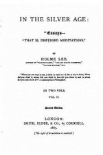
In the Silver Age, Essays-that Is, Dispersed Meditations Holme Lee / С меки корици
common.buy 55 лв
Succession E. van der Maarel / С твърди корици
common.buy 262 лв
Education and Public Policy in Australia Simon Marginson / С меки корици
common.buy 91 лв
Handbook of Microsimulation Modelling Cathal O´Donoghue / С твърди корици
common.buy 491 лв
Enzyme Chemistry Colin J. Suckling / С меки корици
common.buy 388 лв
9th World Luis John Soria / С меки корици
common.buy 29 лв
Meter in Poetry Nigel FabbMorris Halle / С меки корици
common.buy 151 лв
Law's Relations Jennifer Nedelsky / С меки корици
common.buy 169 лв
Shadow State Alan White / С меки корици
common.buy 51 лв

Originally founded in 1863 to promote interest in the history and archaeology of the Huddersfield area, the Yorkshire Archaeological Society expanded its purview in 1870 to cover the whole of Yorkshire. In 1884 it began publishing its Record Series, which aimed to make historical information available through the reprinting of original documents, diaries, letters, and charters. First published in 1933 and reprinted for the society in 1971, this well-illustrated work is an extensive catalogue of maps of the Yorkshire area, drawn between 1577 and 1900. The editor's introduction sets the maps within the history of cartography in Britain, and in the context of pioneering work by previous cartographers. The entries give a description of what each map depicts, along with information on dates and dimensions. This work remains a valuable resource for local historians and geographers.

Информация за книгата

Пълно заглавие Descriptive List of the Printed Maps of Yorkshire and its Ridings, 1577-1900
Автор Harold Whitaker
Език Английски език
Корици Книга - С меки корици
Дата на издаване 2013
Брой страници 318
Баркод 9781108058827
ISBN 1108058825
Код Либристо 02059104
Издателство Cambridge University Press
Тегло 47
Размери 154 x 229 x 20
Подарете тази книга днес
Лесно е
1 Добавете книгата в количката си и изберете Доставка като подарък 2 В замяна ще ви изпратим ваучер 3 Книгата ще пристигне на адреса на получателя

Вход

Влезте в акаунта си. Още нямате акаунт за Libristo? Създайте го сега!

 
задължително
задължително

Нямате акаунт? Използвайте предимствата на акаунта за Libristo!

Благодарение на акаунта за Libristo държите всичко под контрол.

Създаване на акаунт за Libristo